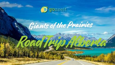
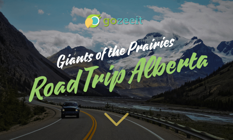
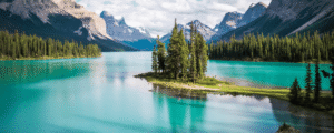
Giants of the Prairies – Road Trip Alberta
For over 40 years, Albertans have been fascinated with “world’s biggest” roadside attractions. From UFO landing pads to various animals to sporting equipment, Alberta’s small towns boast some of the most unusual “biggest” items a traveller can see.
Alberta is diverse, and seeing all the giants would take multiple trips. So, in this post, we will provide road trip routes to groups of these giant attractions. We will aim to get many of them, but we know that are more obscure ones yet to discover. We have provided the routes to the towns as some statues do not have addresses. These are not all the giants in Alberta, but the easiest ones to see in one trip!
The Northern Route
This road trip starts in Barrhead with Aaron the Blue Heron, does a short trip to Fort Assiniboine to see the World’s Largest Wagon Wheel and Pick, and continues Northwest on a former Klondike gold rush route known as the Grizzly Trail to Swan Hills, where the city has constructed a statue of a swan battling a grizzly bear to protect her nest. From Swan Hills, the path turns north to Falher’s World’s Largest Bee, passing by Wiagami Lake Provincial Park, which is worth a rest stop. It has trails, reportedly great shore fishing for pike, ice fishing, snowshoeing, a wading pool for kids, camping, and other outdoor activities. From Falher, travel West to Rycroft, where you have a choice to go North to Hines Creek to see the World’s Largest Railroad Spike at 13′ (4m) or Beaverlodge to see the World’s Largest Beaver. The total trip time without breaks one way is about seven hours.
Look to www.gozeeit.com for events in these areas when you plan your trip.
The South and North Route
Sometimes, it is just nice to use roadside stops for a rest break as part of a larger trip. The South to North route (or the reverse) does just this with stops off the main artery Highway 2, formerly known and often referred to by locals as the Calgary or Edmonton trail, pending your direction of travel. It was renamed the Queen Elizabeth Highway in 2005 in honor of the Queen’s visit to Alberta and as part of the province’s centennial celebrations.
This route has nine giants and is one of the easiest routes to take. At the top end, we start it in Redwater with the World’s Largest Oil Derrick, a historical derrick from Leduc Oil in 1947 situated 40 minutes North of the City of Edmonton’s city limits. We then head South to Ponoka, where the World’s Largest Bucking Saddle Bronc and Rider, “The Legacy,” is found in Centennial Park on Highway 2A. Twenty minutes south, you will arrive in Lacombe at the bright yellow and red diamonded, 40′ (12m) World’s Largest Fishing Lure on Len Thompson Dr. next to Highway 2A. You may want to stay awhile and fish the trout-stocked, catch and release Len Thompson Trout Pond next to the statue.
Heading South again on Highway 2, we arrive at Innisfail and the World’s Largest Animated Bear at the seasonally open Discovery Wildlife Park and campground. It is one of the few animated giants to see, and the park comes with great reviews. Note that pets are not allowed in the park itself.
Next, we head East to the Village of Torrington (population 170), where the 12′ Clem T. GoFur stands, and all 11 of the village’s fire hydrants are painted to look like gophers. Straight South of Torrington is Beiseker, which cares for the giant skunk “Squirt.” Although not as large as other giants, the skunk is comical. Five minutes South, you will find Irricana’s Giant Horse “Smoky” and the Unicorn at the Unicorner Store—both apparently have background stories the locals will tell you.
If your destination is Calgary, you will now be 40 minutes to the city outskirts. But, if you are free for more touring or heading further south, consider Vulcan, a 90-minute drive Southeast of Calgary and home to a Star Trek USS Enterprise replica and an annual Spok Days festival. Vulcan was named after the Roman God of fire. The town was home to a British Commonwealth Air Training Plan station that trained Canadian and allied pilots during WWII. Some of the original runways and hangers can still be seen. Until 1971, the town also boasted holding the largest volume of Canada’s strategic grain reserve. Only 35 km away is the town of Nanton with the Bomber Command Museum of Canada, which showcases a collection of historic aircraft from WWII and has 4.8/5 stars in Google reviews.
The second to the last stop is Bellevue, Alberta, where a 15′ (3m) crow stands on a pole at Crow’s Nest Pass Park. Whether this is a world’s largest or not is debatable as several other cities also have versions of giant crows. In any case, the statue is fitting to the pass.
Our final stop on the North-South trail is Coleman, only 15 minutes from Bellevue. Heading South and a bit West, the route will take you to Crowsnest Pass and the home to the Frank Slide Interpretive Center, which is worth a visit and has high reviews (hours vary by season). Coleman is only 10 minutes past Frank Slide and hosts an old mining locomotive (arguably a miniature, not a giant) that has been turned into a giant piggy bank. Proceeds from this bank go to community improvement projects. Other things to do in the Coleman foothills area include trout fishing in its many streams and lakes; Lundbreck Falls; Castle Falls Provincial Park with its scenic, walkable trails and short waterfalls; the Table Mountain Ridge Viewpoint; and the Oldman Dam Spillway Lookout—a nice location for a picnic.
The total travel time for this route is about 8 hours. Many of the small towns in the area will post more events at www.gozeeit.com, which include rodeos and fairs.
The Eastern Loop
Eastern Alberta loves giant things. This route has the extended version and the short version. The shorter one will be mentioned below. The long route begins in Mundare, about 30 minutes East of Edmonton. Mundare is home to Alberta’s famous Stawnichy Sausage Company. Founded in 1959 as an expansion to the local general store, Stawnichy sausages find their roots in Ukrainian cuisine. Ukrainian cuisine will be found throughout this loop due to the descendants of many Ukrainian and Polish settlers from the Great Ukrainian Migration that began in the 1880s.
Andrew is the next stop, just 21 minutes north of Mundare. The World’s Largest Mallard Duck will be found on the West side of the highway as you enter Andrew. Moving North to Vilna, their giant mushrooms will be seen in the middle of the village, about 800m off Highway 36.
Leave Vilna on Highway 36. The highway will split near Ashmont, with 36 going south and 28 going East. You will need to take 28 until you see the signs for Glendon at Highway 882. Follow 882 North and it will take you right to the giant, 27′ (8m), 6000lb (2700kg) perogy on a fork. What is a perogy, you might ask? It is a dumpling most often filled with potato and another filling like cheese, sauerkraut, or meat. Sweet versions are seen with fruits and berries. It is a lot of work to make so many people buy them from the frozen section of most Alberta grocery stores. They are pan-fried, boiled, or boiled and then pan-fried in butter. They are often served with bacon, green onion, sour cream, or sauerkraut. We like them best with sour cream.
South of Glendon, the Town of Saint Paul boasts a UFO landing pad in the middle of town next to the visitor’s center, St Paul Museum, and town park. The government-funded pad, originally developed in the 1960s during the height of the space race, would technically house a small UFO. How will the aliens find it? Who knows. Other things to do in the area include the Alberta Iron Horse ATV trail, a stocked trout pond, and a Friday farmer’s market. Fishing, camping, and boating are abundant East of Glendon and St. Paul with Muriel Lake, Kehiwin Lake, and Moose Lake all being popular sites.
From St. Paul, the short route goes South to Vegreville for the Giant Pysanka, an ornately decorated Ukrainian Easter egg in another community with Ukrainian and Polish influences. Just 500m southeast of the Pysanka is the Our Lady of the Highway Shrine, a unique and arguably one-of-a-kind shrine in Canada.
If you are continuing along the long route, Whitney Lakes Provincial Park is found between St. Paul and Dewberry, the next stop. The park comprises four large lakes with campgrounds, day-use areas, and accessibility for fishing, canoeing, and boating. Whitney Lake and Ross Lake have several natural sand beaches in the provincial park. It is worth an overnight visit, and many people come to these lakes for the summer holidays.
The hamlet of Dewberry (population 201) is the self-proclaimed Chuckwagon Driver capital of Canada and is named after dewberries that allegedly grow nearby (although we haven’t seen any ourselves). The hamlet boasts a Giant Chuckwagon.
Lloydminster is Canada’s border town, with its giant border poles separating Alberta from Saskatchewan. The border town is a center for processing oil products and agriculture. For things to do, Bud Miller All Season Park has a large pond stocked with trout and is open to non-gas-powered canoes. Disc golf, bike trails, ball diamonds, ice skating, pedal boat rentals, indoor swimming, pickleball, a playground, cross-country skiing, and picnic/firepit areas are all part of this day-use park. Several campgrounds and several hotels are found elsewhere in the community.
Heading south of Lloydminster, Chauvin boasts the World’s Largest Softball named “Susie .”If baseball is not your thing, a gem of a park is found 15 minutes south. Dillberry Lake (part of it is a provincial park) straddles the Alberta-Saskatchewan provincial border. The lake has excellent beaches for the family with warm shallow water, multi-use trails, a playground, camping, day-use areas, and is a great place to pick wild chokecherries to make into jams or syrups when in season. Bird watching, power boating, sailing, and canoeing are favorite pastimes. The provincial park is open from May to September. Check the provincial park website for updated annual season times and ensure you wash off your watercraft before departing to prevent invasive species transfer.
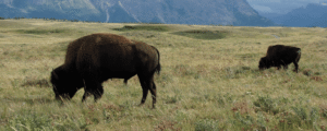
Approximately 45 minutes Northwest of Dillberry Lake sits Wainwright. It has a giant buffalo statue at the corner of Highway 14 and 14th Street. Actual buffalo can be seen at the publicly accessible Bud Cotton Buffalo Paddock at the entrance to the military base (public parking is at the corner). The local military base was once a national park and became a prisoner-of-war camp during WWII. A rebuilt guard tower sits just inside the base entrance and is usually accessible to the public. Don’t miss seeing a memorial clock tower found downtown that memorializes those killed in WWI. It was one of the few structures not destroyed in the 1929 fire. A local museum is found at 1001 – 1 Avenue, and Petroleum Park is found just off Highway 14 at the West end of the town. There, you will see an old oil pump jack made of timbers and iron.
Head West on Highway 14 until you hit Highway 857 and signs for Vegreville, which will take you to the giant Pysanka and Our Lady of the Highway shrine in Vegreville to end the trip.
Total driving time for the extended version of the trip will be approximately seven and a half hours.
For a shorter version of this loop, start in Mundare, go to Andrew, Vilna, Glendon, and Saint Paul, then head south to Vegreville. You should be able to complete the trip in just over three hours of driving. Go to www.gozeeit.com for local events along the route.
This link is for the shorter version
The Central Route
This route uses secondary highways as it is in the middle north-south corridor of the province. It does have some fascinating sights along the way and feel free to take it any direction or just see part of it. We will start with Donalda, about 90 minutes Southeast of Edmonton.
Donalda features a 43′ (13m) tall oil lamp, making it the record holder for the World’s Largest Lamp. The lamp is illuminated at night. While the lamp makes for an interesting attraction, even more interesting is the ecotourism in the area. LaPrairieaire EcoTourism company offers guided tours of the badlands including a dinosaur fossil bed, an Aboriginal historical site, and the remnants of a former coal mine. The Willow Canyon Trail is also a popular spot and hosts cyclists and hikers on its 129-acre plot.
Rochon Sands, about a half hour Southwest of Donalda, is home to Alberta’s largest northern pike fish statue. Yes, there are others like this around the country, but this is Alberta’s giant pike! Next to the pike is Rochon Sands Provincial Park, one of Alberta’s older provincial parks. The park hosts unserviced RV and tent campsites, a day-use area, and a small beach with shallow water. Two beach accesses to Buffalo Lake are also found outside the park.
The most significant highlight on this route is Drumheller, home to the Royal Tyrell Museum, one of the world’s most renowned museums. Tyra, the World’s Largest Dinosaur, measures 86′ (26m) by 151′ (46m) but will only be on display until 2029, after which it is slated for demolition due to maintenance costs. Notwithstanding, the museum is well worth the trip.
Hanna is just under an hour’s drive to the Goose Statue at 217 Palliser Trail. No one seems to know why it is there. It just is. Travelling south to Vauxhall, you will find Sammy and Samantha Spud on Highway 36. Vauxhall declares itself as the “Potato Capital of the West,” and you may even smell the production of dehydrated potatoes as you pass through.
Taber is famous in Alberta for corn, so it is fitting that it has a giant corn stock. The giant stock can be found at 50 St and Highway 3/36 Crowsnest Highway. Taber corn is particularly prized due to its sweetness and flavor that it develops uniquely in the area due to irrigation, warm days, cool nights, and soil. It can be seasonally found from July to September across the province, although there are those who will tell you they have it, but do not. To quote one seller from a radio program years ago “Of course this is Taber corn, grown right here in Wetaskiwin.” A cornfest is usually held in Taber in August. Writing-on-Stone provincial park is an hour South of Taber. It has camping, firepits, hiking, canoeing, and swimming in the warm Milk River in the summertime. Maps, guides, and interpretive program information can be found at https://www.albertaparks.ca/parks/south/writing-on-stone-pp/information-facilities/day-use/writing-on-stone/.
Bow Island is about 35 minutes from Taber driving East. Here you will be treated to two giants: A giant sunflower and the world’s largest pinto bean, “Pinto Macbean,” with 4.9 stars on Google reviews, what could go wrong. The town of 2000 is host to advanced irrigation systems, oil and gas, the largest spearmint oil producing region in Canada, mustard, and, of course, pinto beans. It was formerly the home of Spitz sunflower seeds (hence the giant sunflower), but the sale of the firm to PepsiCo saw production moved to the US in 2018. The giant sunflower is 8 km West of Bow Island on Highway 879.
Finally, Medicine Hat boasts the world’s largest teepee on the TransCanada Highway. It was originally constructed for the 1988 Calgary Winter Olympics but now resides in “The Hat.” The structure’s poles are as tall as a 20-story building, and the diameter is 160′ (48m), weighing in at 800 tons. It overlooks the Saamis Archaeological Site, once an ancient buffalo processing and campsite. The site is believed to contain millions of artifacts. The city’s 330 sunny days, warm summers, and not-so-cold winters (by Alberta standards) make it well-suited for its 190 kilometers of multi-use trails.
For more things to do, go to www.gozeeit.com for the most current events along the route.